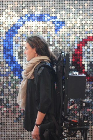
Google Unveils The Cartographer, Its Indoor Mapping Backpack

The Cartographer uses a process called “simultaneous localization and mapping” (SLAM), a technique that’s typically used for mapping new locations and that Google is now putting to use to map anything from hotels to museums.
As the backpacker walks through a building, the floor plan is automatically generated in real time, Google says. The wearer also uses a tablet to add points of interest while walking around the building (say room numbers in a hotel or the exhibits in a museum).
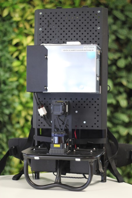

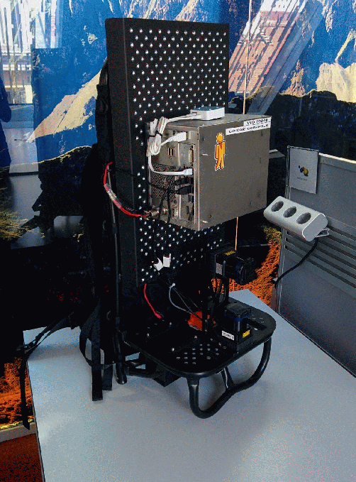
The backpack sure doesn’t look as slick as the latest versions of the Trekker. Indeed, the setup looks more like a desktop computer bolted to a metal platform with a couple of sensor underneath it.
Still, Google has shown quite a bit of interest in bringing better indoor maps to market over the last few years and the list of available locations has grown quickly and building owners can also upload their own maps now, too.
With Project Tango, Google even has a tablet on the market (for developers) that has very advanced 3D sensors that could be used for mapping indoor environments. Google however tells me that this project is completely separate from Project Tango. Instead, the backpack features multi-echo laser scanners (judging from Google’s images, the backpack features two of these $4,500 units) and an inertial measurement unit.