After just under a year in preview, Google today announced that it is now rolling out the new Google Maps to all of its users as the default option.
Since Google announced the new version of Maps at its I/O developer conference last year, users were able to switch between the two versions. Still, the majority of users, the company tells me, remained on the old version. Starting today, Google will slowly switch everybody over to the new Google Maps. This roll-out will take a few weeks and users who dislike the new version will be able to switch back to the old one for the time being, though at some point, Google will likely turn off the old Maps.
The new version Google announced last year was relatively basic, so until now, Google kept it as an option and didn’t move all users over to the new experience. It was still missing a number of important features, but Google also wanted to get it out at I/O 2013 to see where it still needed to tweak the service and how users would react to it.
Now, Google considers the new Google Maps on par with the original version in terms of features and is starting to push it out to all users worldwide.
Google Maps’ lead designer Jonah Jones told me that over the last few months, the team focused on speed improvements, reducing clutter and bringing back features like the pegman and routing to multiple destinations, as well as Google’s new 3D Earth tours, and the integration of traffic accident data from the recently acquired Waze.
New users will immediately notice the difference between the two versions. The new Google Maps does away with the old sidebar and puts the map front and center with a small white input box in the top left corner.
With regard to features, the biggest difference between the old and the new version of Maps, though, is that this new version is completely personalized for every user. It will mark places you’ve rated and draw subtle outlines from your current position to a place you select on the map, for example. It will also automatically highlight related places on the map when you select a restaurant, for example.
According to Jones, the main idea behind the redesign was to make the experience as immersive as possible and to remove clutter by only giving users the information they need.
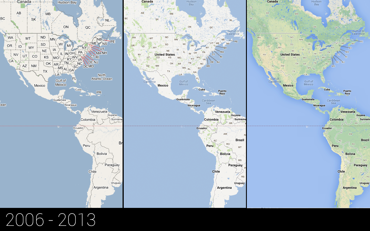
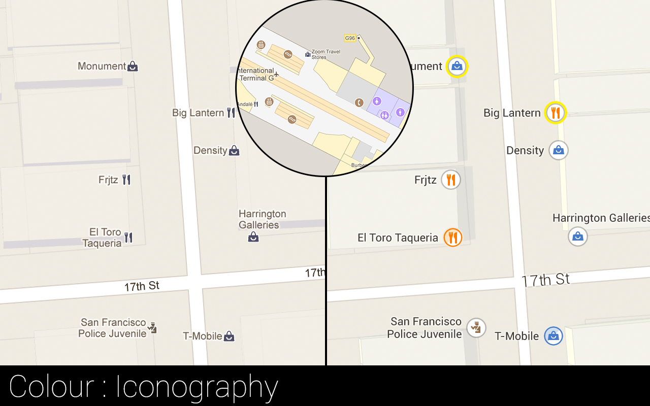
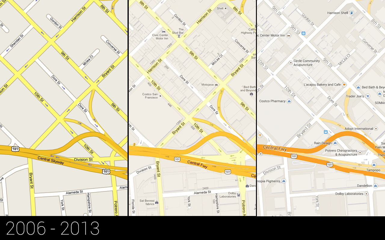
Over the course of Google Maps’ history, this has meant deemphasizing roads, for example, as the company added more landmarks and other information to the maps. In early versions, all the text was bold, too. Now, the company uses more complex typography to indicate the information that most likely matters to the user. This also meant muting some of the colors and tweaking some of the iconography used in the maps.
Most of the early feedback for the new Google Maps was very positive, Jones told me. What did surprise him, though, was that users missed the pegman so much, even though Google had built other ways of accessing Street View imagery into the new version. He also noted how users love to zoom out all the way back into space (which then shows the earth with a real-time cloud layer on top).
One thing new users quickly picked up was the image carousel at the bottom of the screen that appears when you switch to the 3D Google Earth mode. Because Google wants to make the experience as full-screen as possible and still remove clutter, it moved images and panorama photos into the carousel. It also now uses this space to highlight Street View imagery.
Jones also told me that he was never a huge fan of how Maps used satellite imagery. “We always had this implicit idea that we had to show the same information in satellite maps as in our other maps,” he told me. “That may have been a mistake.” Now, with the personalized maps, the team was able to also change how it displays information in the satellite view and tweak it accordingly.
Much of this personalization, but also the 3D mode and other features, are now possible because Google moved away from the tile-based system of the early Google Maps. Those early versions basically downloaded a PNG for every time, which didn’t allow a lot of flexibility. The new version is vector-based, which allows for real-time changes and reduces the amount of bandwidth needed. New web technologies like WebGL now also make the Google Earth-like 3D mode possible and ensure that even an app as complex as Google Maps works as smoothly as it does. On the backend, the team also put quite a bit of effort into making the personalization as seamless as possible.
For a closer look at all of the new features in the new Google Maps, take a look at our deep dive from last year.