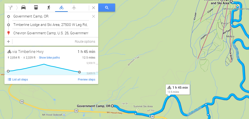
Google Maps now features elevation profiles for bike routes.
Google added biking directions to Google Maps and specialized maps that highlight bike routes a few years ago. If you are weak like me, though, and learned to bike in Holland, where the biggest obstacle is a dike, you don’t just want to know what streets to take, but also what hills you will have to huff your way up on the way to your destination.
Until now, Google was no help there and you needed to go to third-party sites that mashed up elevation data with Google Maps routes. Now, however, Google has quietly added this feature to Google Maps directly.
We asked Google about this and the company confirmed that this is indeed a new — and as of now unannounced — feature. It looks like the elevation profiles are available in all the 14 countries Google offers biking directions. These include Austria, Australia, Belgium, Canada, Switzerland, Germany, Denmark, Finland, Great Britain, Netherlands, Norway, New Zealand, Sweden and the US
Just look for a route on Google Maps, choose the biking directions and look for the new elevation profile. Besides the graphical representation of those hills you will have to climb, the new card also shows you the total number of feet you will have to climb on your route (and those joyous miles you get to just kick back and try not to die while you barrel down the hill on the other side).
The only time you won’t see the new elevation profiles, it seems, is for routes that are essentially flat.
For now, these profiles sadly don’t appear in any of Google’s mobile apps for Google Maps, but chances are the company will add it to those apps in the long run, too.