
Strava is introducing a new feature called Flyover, which allows users to replay their activities via a 3D video map.
Flyover is powered by Fatmap, a 3D mapping platform that Strava acquired earlier this year.
The feature is available to premium Strava subscribers only, and is accessible by clicking on an individual GPS-powered activity, then hitting the little “flyover” button on the bottom right. It also works with all historical activities saved to a user’s profile.
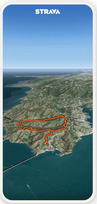
Strava’s Flyover. Image Credits: Strava
It’s worth noting that a third-party app called Relive once offered something similar to this, funneling in data from your Strava or Garmin profiles to serve up 3D animated videos — however, Strava cut off support for Relive several years ago.
Strava first teased Flyover earlier this year, and the company has been slowly rolling out the feature to Android users for a couple of months already, with today signaling its official “launch.” However, iOS users will have to wait a while longer, with plans to expand the feature to iPhone by early December — and there’s no official word yet on when it will arrive for web users, if at all.
Fatmap was founded a decade ago and was originally focused on serving ski resorts with high-resolution digital maps, but in the years that followed it bolstered its platform with additional data from satellite and aerospace companies to become a sort of Google Maps for the great outdoors.
While Fatmap still exists as a standalone product for now, Strava has been gradually integrating the two platforms — first through single sign-on (SSO) functionality that allows Strava users to log in to Fatmap using their existing credentials, and more recently by introducing static Fatmap maps to Strava activities. 3D video flyovers is the next step in this integration.