Google isn’t the only company working on mapping out the entire world with satellite imagery and detailed information about every nook and cranny in the universe. Two companies are teaming up to create publishable information on your site or news article using detailed satellite imagery and advanced publishing tools.
Skybox, a company that has raised $91 million to launch its own satellites into outer space to capture detailed imagery of our streets and buildings, is working with MapBox, an OpenStreetMap contributor, on some pretty sweet analysis and publishing tools. Two Skybox satellites will be launched this summer, so the tools are coming at the perfect time.
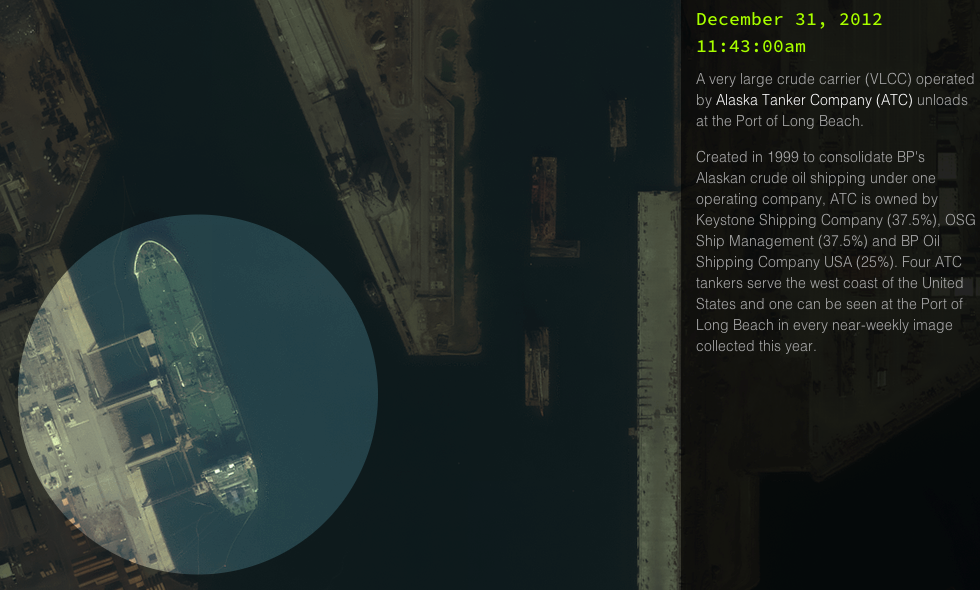
One of the examples of analyzing all of the images that Skybox captures, is a “change detection” system that focuses on one area and builds a playlist of photos that you can go through to detect changes in the area. Why would something like this be useful? Well, say you’re a company that has a fleet of ships and wants to know when they dock and leave. This tool could help track that:
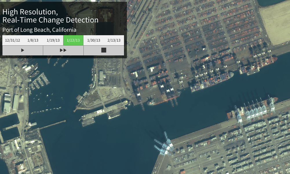
Additionally, MapBox provides tools that allow anyone to annotate imagery. In the example above, you could easily add notes to each coming and going ship that you’ve detected, with important context that will help you go back in time to make sense of all of the imagery you’ve collected:
When I spoke with MapBox’s founder, Eric Gundersen, about the project, he pointed out that what you can do with maps is very limited right now, which is what makes this partnership important:
You can’t annotate images, you can’t zoom in, can’t interact on your tablet. This is our first experiment of “how do you package up information along with data,” that would usually be a PDF.
As Gundersen pointed out, the information that the tools above allow you to surface and track would normally be passed around in a huge Word document or PDF, which is a pretty rough and manual process for people who are analyzing thousands of images a day.
MapBox, which is fully bootstrapped, is working on some other really neat tools on their own, which should be available in the coming weeks. Think Google Map Maker, but easier to use and more available to the community that is already participating on the OpenStreetMap project.
[Disclosure: CrunchFund is an investor in Skybox, but had nothing to do with this post]