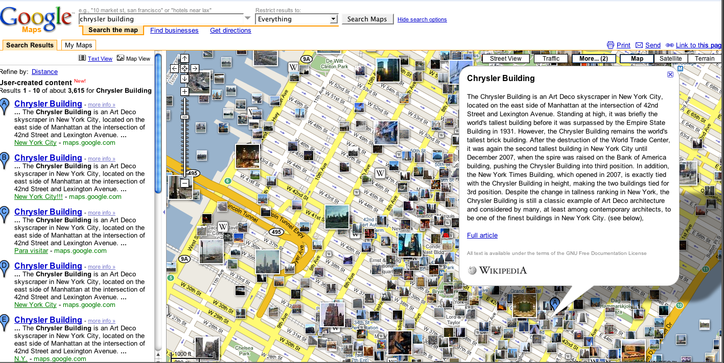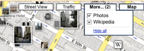
If you go to Google Maps, you’ll notice there is now a “”More” button right next to “Street View”” and “Traffic.” If you click on it after getting a map, you will be given the options to tick “Photos” or “Wikipedia.” Ticking the first option populates teh map with geo-tagged photos provided by Panoramio. Ticking the second gives you geo-coded Wikipedia articles. For instance, I found entries on a New York City map for the Chrysler Building, Grand Central Station, the New York Yacht Club, and other landmarks.
The more that Google can populate maps with data, the more useful they become. I’d like to see geo-coded Flickr photos on there as an option. Maybe Jerry Yang can negotiate that as an extra if any search deal goes through. Yelp reviews would also be cool. What other data overlays should Google add to the “more option? What other buttons would readers like to see as well?
Update: Google has also integrated real-estate listings if you click on the “show search options” link. you can search by real estate, businesses, locations, user-created content, and mapped Web pages.
(Hat tip to Google Maps Mania).