Religion and technology are not two phrases that often go hand in hand. Molly Burhans is looking to change that. Growing up Catholic in upstate New York, Burhans had the intention of becoming a nun. However, after studying landscape and ecological design in graduate school, she discovered a different calling.
In her coursework, Burhans begin using geographic or geospatial information systems, GIS, to better plan wetland restoration on individual parcels of nearby land. GIS is a general term for a tool that allows users to store, analyze and visualize layers of information over a map. Today the technology is used in a variety of ways — to predict earthquakes and the presence of oil reserves, model the impacts of global warming and monitor the global spread of disease.
Burhans began researching the land holdings of the Catholic Church and was surprised to find that none existed. It is said that the individual dioceses, various Catholic religious orders and the Vatican in aggregate comprise of the world’s largest land holders. Exactly how much land appears to be unclear. Like so many industries, the Church has struggled to modernize its data set. According to Burhans, much of the information is dispersed, contained within .PDFs in dioceses or local parishes. Opportunities for better land planning around the Church’s holdings were nonexistent.
Burhans founded GoodLands to use mapping technologies to do just that. Ultimately, she hopes that the data can be used to “create a greater sense of stewardship” in communities and promote positive change in planning for environmental and social change.
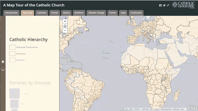
To date, GoodLands has mapped 35,000 Church properties in the U.S. as part of their Catholic Geographic Information Systems Center (CGISC). To gather the raw data, GoodLands partnered with parishioners, academic institutions, NGOs and other social services.
Today, GoodLands is announcing a partnership with ESRI, the global leader in GIS. With ESRI’s technology, GoodLands will be able to visualize and analyze the data to present a global landscape of holdings overlaid with the structure and population distribution of the one billion-plus Catholics globally.
Burhans recently traveled to Rome to participate in the Vatican Youth Symposium. CGISC has been approved by the Vatican’s Technology and Arts Council, hopefully indicating an openness from the top to collaborate and act on the findings of GoodLands’ research.
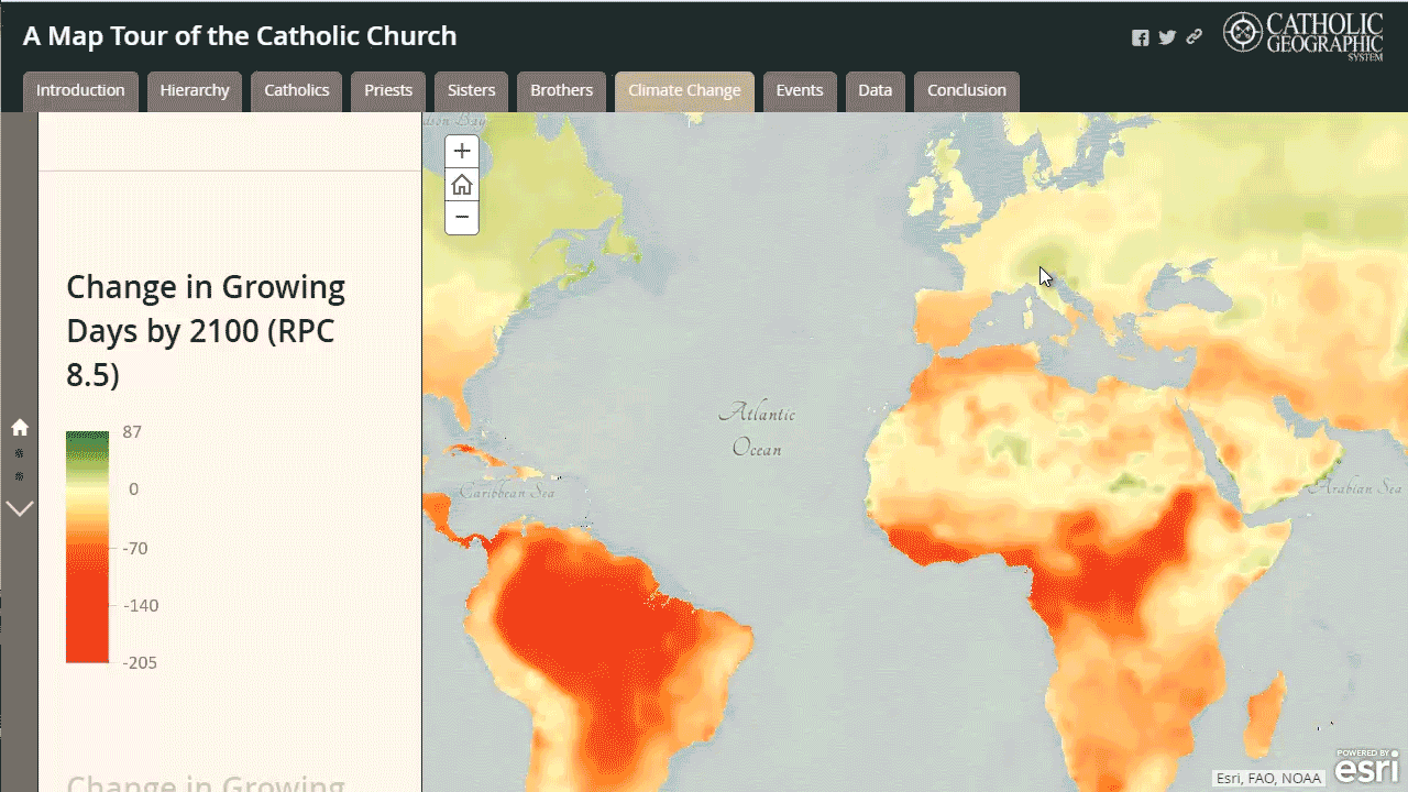
A more compelling early use case that GoodLands has mapped has to do with climate change. Using climate models available through ESRI, CGISC can identify parishes significantly impacted by global warming and visualize a map of growing-season reduction. This could allow parishes to better serve the needs of their communities by planning more focused outreach, education and service efforts.
In a related example, using weather prediction models, GoodLands can show the Church which dioceses are likely to need aid or assistance in the coming years based off likelihood of hurricanes and other destructive natural disasters.
Today, nonprofit GoodLands’ vision is much broader. The company aims to have a hybrid structure, part nonprofit, part for-profit, that sells various mapping models. The company also has future plans to assist parishes in their own land planning efforts.
Burhans is honest when she says that the true geo/religious impact of GoodLands’ work is unclear. Still, it’s interesting to see one of the oldest institutions on earth collide with technology.