Google is introducing new Maps features to make it easier for users to navigate national parks using the app. The tech giant says the new updates are designed to help users find the information they need when visiting a national park, such as discovering things to do and finding your way around the park.
With this update, when you search for a trail, Google Maps will highlight the entire route on the map, instead of just a pin. The company says this feature is meant to help people easily identify where a trail ends and starts, and what the route looks like. You’ll also be able to see reviews and photos from the Google Maps community. The app will surface helpful details from the Maps community, such as what type of trail it is, its level of difficulty and whether it’s better for running, walking or biking.

Image Credits: Google
Google Maps is also making it easier to quickly identify the most popular places in a park, such as attractions, campgrounds, visitor centers and trailheads. If you’re planning to visit a national park, you can search for the park and see photo highlights for key attractions from the Maps community. You can tap on the photos to get additional information, like videos and reviews.
In addition, the app is providing users with more precise directions. Later this month, users will start to see park entrances highlighted on the map, and now when you request walking or cycling directions to a particular trail, Maps will direct you right to the trailhead.
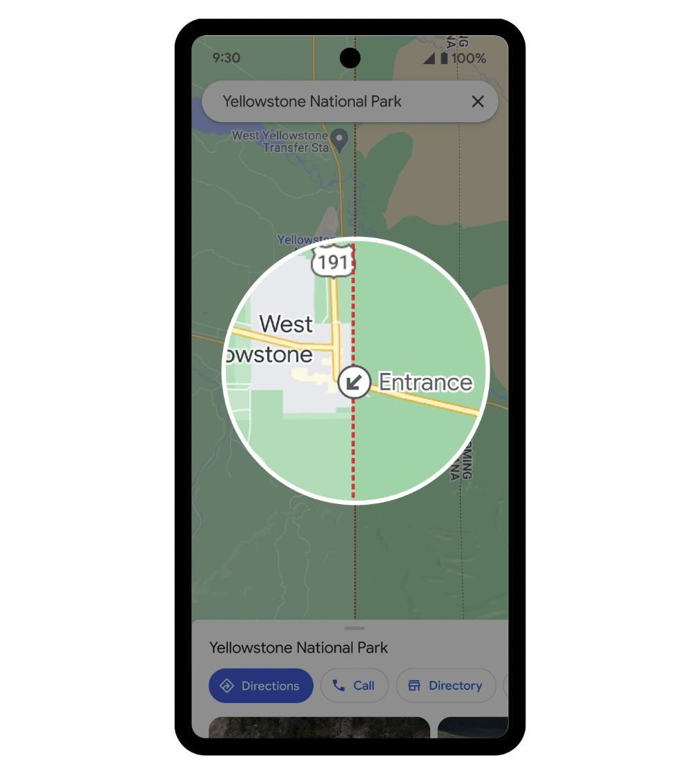
Image Credits: Google
Google is also launching a new way to download an offline map for a park. Users can tap the “download” button on the park’s Google Maps listing to download it for offline use. With this option, you can easily find your way around without internet access or cellular data. The download button will appear on park listings later this month, Google says.
“These features are coming to all U.S. national parks this April, and they’ll roll out to parks around the world in the coming months,” the company wrote in a blog post. “Whether you’re making your list of must-see sights or trying to find the best trail for running — Google Maps has all the information you need in one place so you can save time planning and spend it exploring.”
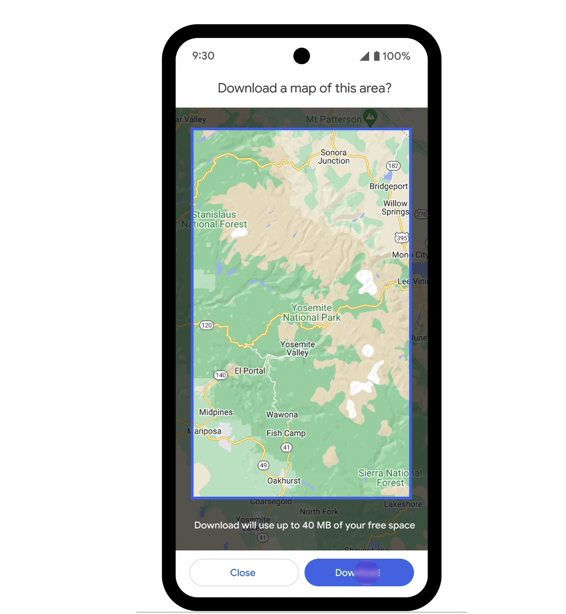
Image Credits: Google
It’s worth noting that the launch of the new features sees Google Maps inching into AllTrails’ territory. The fitness and travel mobile platform provides users with thousands of crowdsourced reviews and images. Of course, AllTrails covers more than just national parks, so Google is still fairly new to the game.
As part of the announcement, Google shared that Great Smoky Mountains National Park is the top-rated national part in the country, according to Google Maps data. The park is followed by Bryce Canyon National Park, Glacier Bay National Park and Preserve, Kenai Fjords National Park, Rocky Mountain National Park, Acadia National Park, Badlands National Park, Mount Rainier National Park, Carlsbad Caverns National Park and Grand Teton National Park.