
LeoLabs has been building out its global network of space-scanning radars for the last couple years, leading up to today’s launch of its Collision Avoidance system, essentially satellite-monitoring-as-a-service. It should prove an indispensable asset to startups that don’t happen to have their own state of the art radar setup.
Space is full of junk, and it isn’t tracked as closely as anyone would like. A bit of debris the size of a pebble could put nearly any satellite out of commission, and there are thousands upon thousands of them in unknown orbits.
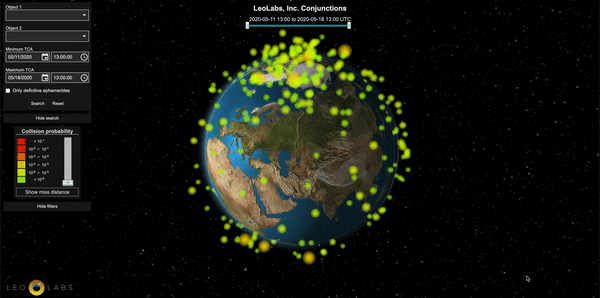
Most debris tracking is done by a motley collection of radars administrated by the U.S. Air Force and other government entities, but they’re limited in the precision and accuracy of their readings. LeoLabs aims to augment these capabilities with its own system, which can monitor more and smaller debris.
The company put the finishing touches on its newest radar antenna in New Zealand late last year, completing the network it needed to assemble to provide global coverage. Having kicked the tires for a bit with a group of early customers (Planet, Digital Globe, Black Sky and the Air Force Research Lab), the company is now ready to open the doors to its product to all and sundry.
Like any other modern data product, Collision Avoidance (as it is called) is completely cloud-based. You subscribe to the service and provide the requisite details, allowing the system to identify your assets in orbit. From then on you receive automatic alerts should, for instance, any tracked objects enter a potentially threatening orbit or some new piece of debris come worryingly close to yours (these are called “conjunctions”). It can also provide direct observational confirmation of your satellite’s position and trajectory, should you for some reason suspect the telemetry is off.
Perhaps the most important part is simply that it’s all very responsive. If you’re exploring 10 different possibilities for a maneuver to raise a satellite’s orbit, you don’t need to email the Air Force 10 times and hear back hours or days later. You can check the safety of a maneuver in real time, or once committed, request the radar scan your satellite — within minutes, not days — to make sure that it accomplished it correctly.
That kind of capability has always been lacking in space applications, which are often mired not just in red tape but in uncertainty of timelines and the immense complexity of the crowded zoo that is low Earth orbit. Being able to just sign up for it like any other enterprise service is a huge convenience for both large and small space companies.
Right now LeoLabs has three radars that cover a great deal of the sky, but it’s planning three more to increase the frequency with which satellites can be seen and tracked, especially those in equatorial orbits.
“Never before has a single end-to-end solution, from radars to web application, been available as a commercial off-the-shelf service,” said a proud-sounding Michael Nicolls, co-founder and CTO of LeoLabs, in a press release. “This turnkey SaaS solution puts a simple face in front of the sophisticated cloud-based astrodynamics platform and network of ground-based radars.”