If you could digitise whole, real-world locations, you’d automatically improve the planning for big infrastructure projects that require buildings, bridges tunnels and the like. Some $94 trillion in infrastructure investment is required by 2040 globally to sustain global growth predictions, yet infrastructure is one of the least digitised sectors in the global economy.
SenSat is a U.K. company using AI to create digital representations of real-world locations. It has now raised a $10 million Series A funding round, led by internet giant Tencent, with participation from Sistema Venture Capital.
SenSat creates “digital twins” of locations. The result is an accurate, digital and up-to-date copy of the real world in a machine-readable format. This enables industries, such as infrastructure, to make more informed decisions about big projects. This improves safety, cost-efficiency, waste generation and project collaboration, and reduces the carbon generated in the project.
James Dean, co-founder and CEO of SenSat says: “SenSat has a simple but profound goal: to build the third platform, an intelligent eco-system that translates the real world into a version understandable to AI. This technology will help us to build a more sustainable future, using the wealth of new insight to help humans make better decisions.”
Dr Ling Ge, Chief European Representative at Tencent Holdings, who will be joining the SenSat board, explained: “We are delighted with our investment into SenSat, which aligns well with the ambitions of Tencent’s Cloud and Smart Industries Group. We believe SenSat is well positioned to introduce mass digital automation to offline industries that have not yet engaged in the digital revolution; and we look forward to SenSat applying its platform to a broadening range of smart industries.”
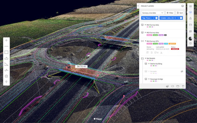
SenSat’s Mapp platform allows infrastructure companies to interact with their workplaces digitally by allowing digital automation to help them make better decisions with real-world data.
Mapp has more than 30 international infrastructure companies using it now. As part of a project with Murphy Group for the U.K. National Grid, SenSat digitized a 52 km underground transmission line as a part of the Triton Knoll offshore wind farm project, resulting in reducing time on site by 200%, it claims.