At the Disrupt SF 2017 Hackathon, a massive swath of the 102 companies that took the stage on Sunday presented hacks with disaster relief in mind. From ResQme to ResQMi to RescueMe, if you can think of a phrase with the word “rescue” in it, it probably showed up on stage among the roughly 30 emergency and disaster related hacks.
Most of the disaster-related apps that presented today mentioned the recent events of Hurricane Harvey and Hurricane Irma in their pitches, observing that tech should be able to pair victims, resources and rescue workers far better than existing services. Many of the rescue-oriented apps that took the stage acknowledged that mobile data services usually go down during these events and the vast majority of them offered an SMS-based version of their hack.
While some hacks addressed specific disaster scenarios like emergency ridesharing and drone rescue operations, nearly all of the disaster-related apps mentioned failings of modern emergency management, like a “lack of communication” between victims and rescuers and the absence of a “cohesive program” tracking realtime rescue and relief efforts.
Here’s a selection of the notable disaster relief hacks from 2017’s Disrupt Hackathon:
RescueCom: “An accessible and frictionless way to communicate in emergency situations.” The service offers geofenced chatrooms with alerts from emergency services highlighted in red with all messages geotagged. “Once a disaster starts you don’t always always have time to download an app” so readouts of the messages are also available via a phone number.
Torchlight: Brings relief assistance and transparency to those displaced by disaster. Torchlight helps friends and family check in and helps evacuees find and evaluate the shelters around them. Shelters can use built-in support for Intuit Quickbooks for shelter inventory management.
Smart voice disaster responder: A voice responder that fields emergency messages and lets you check in on when responder will arrive.
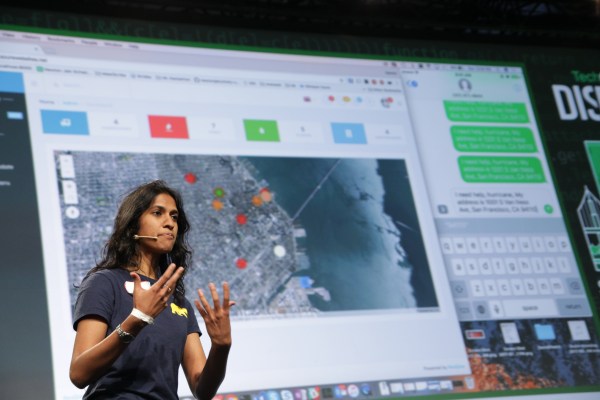
Rahat: Rahat offers gridded heatmaps of regions affected by disaster using ESRI’s multi-layer data capabilities.
Shepherd: Victim sends a text message to network, app shares it with rescuer network. According to Shepherd’s creators, “we’ve built a landline network to help make this possible.”
Cithaeron: Map-based checklist-style service annotating which supplies and services victim needs with built-in tracking for rescuers.
Escape Carpool: A service for coordinating ridesharing during emergencies that helps riders find a car and dictate a time to leave.
Onfire.io: “What were created is a firefighter team monitoring platform.” Onfire measures a firefighter’s vital signs, heart rate and exposure to harmful chemicals in the environment.
Someone Here: According to Someone Here, “We found out the main problem is the lack of communication between people who need help and people who can provide help.” Using ESRI offline maps, rescuers can see who needs help in the area and let them know help is on the way.
RescueMe: “It’s like Uber for disaster-related rescue missions.” Sign up for help or to get help, enter rescue requirements, be matched and receive a text when help is on the way.
HelpHaste: Helphaste wants “to coordinate victims and rescue operations” via public safety broadcast data, using LIDAR to map insides of buildings. This addresses the “major pain points” of relief operations.
ResQMi: “Your personal dispatcher” that sends automatic SMS to nearest rescuers, family, and friends. You can see their status whether they need rescue or are being rescued. Provides in-app communication to police, fire stations, etc.
Flare: Users can drop a pin on the map, request help, and responders can view these and respond to time-stamped requests in order.
AidPins: Built on the Mapquest API, you can submit your contact info and any help you might be able to provide. Victims can log into the site to see what help is available and what resources community members have to give.
ResQme: “There’s absolutely almost no connectivity in any disaster struck area.” Provides you text broadcasting in realtime using Nexmo and Mapquest.
RescueChain: “People didn’t know what to donate… the things that they really needed couldn’t be delivered.” RescueChain focuses on the post-disaster relief phase, aggregating requests for services like food, water, first aid and medicine with SMS support for when data is down.
DroneAid: Using Mapquest to find an optimized map for drone reconnaissance missions. The service classifies images in real time and takes pictures using voice commands.
DisruptRescue: With its creator a recent disaster survivor himself, he observed that “this is the app that we wish we had.” DisruptRescue lets those affected request help with a simple interface “that a 65 year old grandfather… could figure out in under 60 seconds and get rescued on.”
During Hurricane Harvey, disaster victims shared their locations, called for help and connected over Twitter while a handful of more purpose-specific chat apps rose to the occasion. Still, major gaps remain in identifying, aggregating and responding to calls for rescue and ongoing resource needs, like food, water and shelter. If Disrupt SF’s 2017 Hackathon is any indication, help may be on the way.