
The number of things that can be done from the comfort of one’s own bed has increased in recent years — shopping, banking and now geospatial analytics. OK, it doesn’t sound sexy, but it might give you a leg up the next time your friend starts an arcane argument with you over whose neighborhood historically has more vehicles on the road.
With SpaceKnow’s online analytics platform, you can quickly whip up a count of cars within any given satellite image. From there it’s easy to compare changes over time with historical imagery. SpaceKnow also makes it possible to break down the amount of space dedicated to water, nature and development within a designated area.
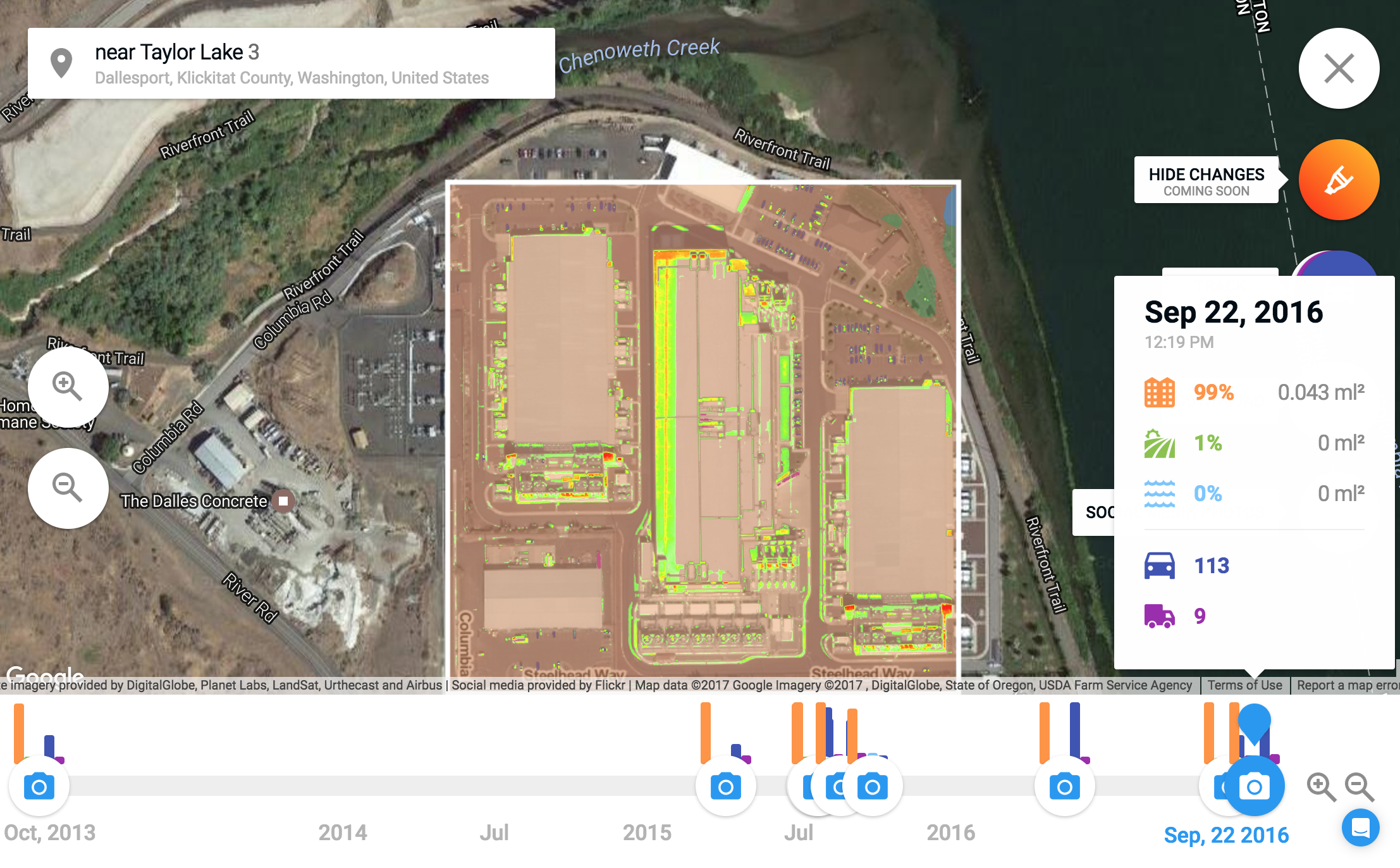
Experimenting with images of Google’s data center, The Dalles, in Oregon, you can easily see obvious changes like the expansion that occurred between 2013 and 2015. But SpaceKnow’s platform also makes it possible to see less obvious changes, like the increase in cars after the construction was completed on the new building.
DigitalGlobe imagery analyzed by SpaceKnow
Consumerization is knocking on the door of geospatial analytics startups. Last month, Planet launched its Planet Explorer Beta on the stage of Google’s Cloud Next conference. The platform solely lets users compare satellite imagery across time in its free intuitive web interface. Other projects, like Descartes Labs’ GeoVisual Search and Carnegie Mellon’s Terrapattern, have made it possible to search for objects within satellite imagery.
Each competitor in the space wants to show off its technical capabilities while raising the bar on what can remain part of a paid enterprise tier. SpaceKnow analytics offers consumers just a taste of what is possible with geospatial analytics. The startup aims to differentiate by maximizing the sources of input imagery it can process.
“We built a proprietary platform that lets us combine imagery from multiple providers,” explains Pavel Machalek, CEO of SpaceKnow. “It might seem obvious, but it’s hard from a technical perspective because that imagery is in very different formats.”
Because the analytics are computationally intensive, the company hasn’t fully committed to opening up the feature for good. For now, if you want to take advantage of it, you’ll have to put in a request through a chat window inside the web app.
This isn’t ideal, but it does give a behind-the-scenes peek at costly B2B geospatial analytics technology. You can access SpaceKnow analytics here. And if, for whatever reason, you have trouble, let me know in the comments.