Heavy equipment makers Deere & Co., better known as John Deere, have forged a strategic alliance with drone-tech startup Kespry, the companies announced Tuesday in Las Vegas at CONEXPO, an international trade show for the construction industry. The deal could prove a boon for sales of Kespry’s drones and data analytics software. It could help John Deere tap into a new, high-tech means of generating sales and profits in construction and forestry, an area in its overall business that slumped in 2016.
Based in Menlo Park, Kespry helps mining, construction and other businesses put drones to work gathering data and images from on high, then using these to decide where and how to cut costs and improve productivity and safety on job sites. Kespry offers cloud-based software and big data analytics, as well as their own unmanned aerial vehicles. A predecessor that does not have its own hardware to offer but does provide sophisticated software and analytics to the same industries, Airware, has a similar partnership with and an equity investment from Caterpillar.
Through the new partnership, John Deere construction and forestry equipment dealers will offer their customers Kespry Aerial Intelligence systems for use on job sites around the world. Kespry leases its drones but does not sell them outright. John Deere offers a mix of leases and sales.
Why would John Deere equipment users want Kespry’s drones and software? They capture topographic data that can be used to guide projects in road building or maintenance, or to understand volumetrics, meaning how much is growing in, or coming out, of a given tract of forest.
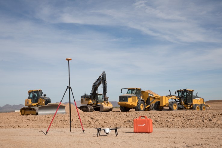
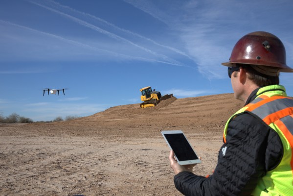
John Deere construction and forestry equipment, with a Kespry drone.
Recently, Kespry appointed a new CEO, enterprise software veteran George Mathew, formerly the president and COO of Alteryx. It also released the Kespry Drone 2, which can take off, fly a mission along a designated path and land without needing human operators at the controls every minute.
The Kespry Drone 2 has one-dimensional, forward-facing lidar sensors that help the flying robots avoid obstacles like trees, cell towers or other structures. That could come in handy around ever-changing construction sites, and forests where trees fall unexpectedly. The company’s latest drone also uses precision GPS to create three-dimensional models of everything below. The models are accurate within centimeters, which could help architects and construction businesses gauge progress or issues on various jobs.
Mathew said, “Kespry from the get-go had the idea to make a complete, turnkey intelligence platform to really serve a specific set of users. The first use case was in mining and aggregates where we have acquired over 100 customers last year. Now we are simply expanding where we see demand.” Mathew views drones as “the new sensor network,” and believes this technology will completely transform heavy industries over the next decade.