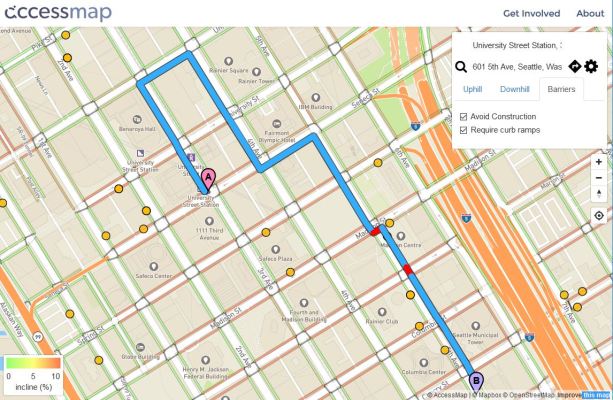
If you ask your favorite mapping app for walking directions from point A to point B, it’ll do its best, but what if you happen to be in a wheelchair? Google and Apple Maps don’t have information on curb cuts, safe crossings, construction sites that interrupt sidewalks, and so on. AccessMap attempts to address this shortcoming, and now offers route-finding in Seattle that takes into account the user’s level of mobility.
The project has been underway for more than a year, collecting data and putting together the platform, and the team presented some of their work this summer as part of a University of Washington program focusing on municipal data. But this is the first deployment of the automatic route-finding system.
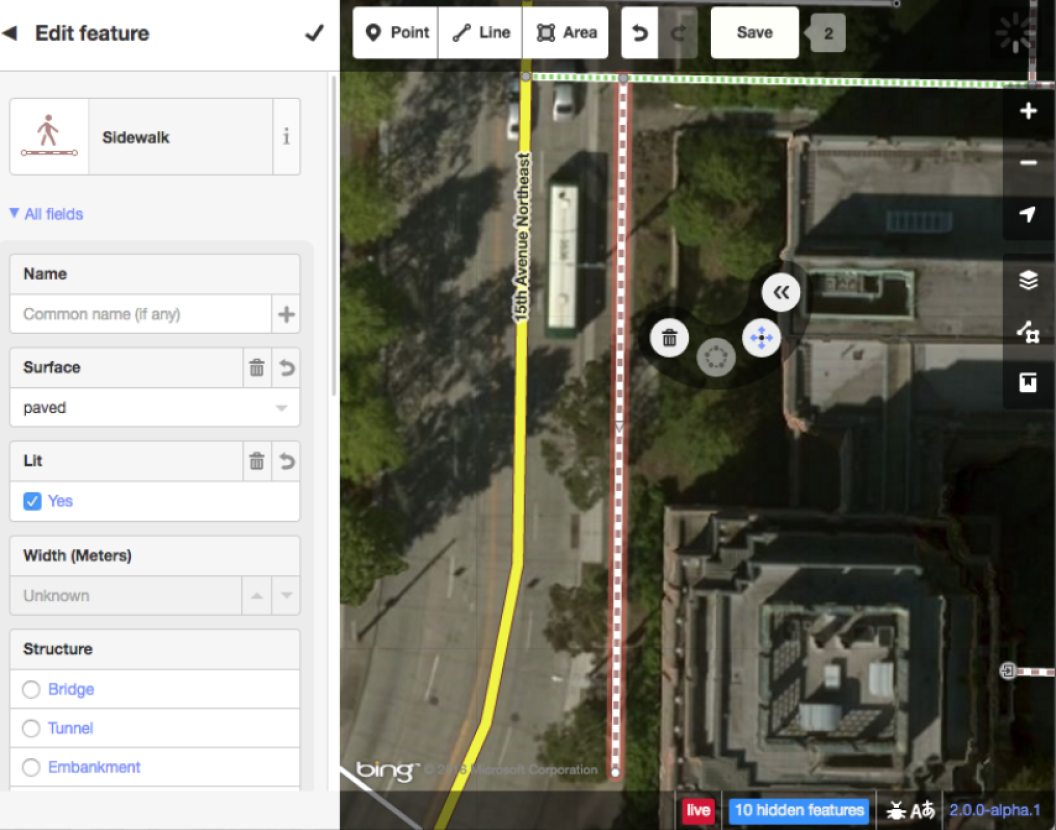
There’s a lot of data to wrangle: While ordinary maps are largely traffic-focused, OpenSidewalks needs info on everything from the grade of hills to the condition of the pavement. Volunteers have collected a great deal of that data in the downtown Seattle area, though some items (like construction zones and other major sidewalk disruptions, which we have more than our share of right now) are collected from official filings.
When you put in your starting point and destination, you can also select your mode of mobility and set limits on how steep hills can be — with separate settings for uphill and downhill, of course.
 “Identifying routes that optimize not for time or distance but for things like changes in elevation and curb cuts is a really big and important change,” said Anat Caspi, one of the project’s leads, in the UW news release. Indeed, accessibility for populations like the disabled, vision-impaired and others is generally a secondary consideration for mapping tools, if it’s included at all.
Ten other major cities are being targeted for rollouts: New York, Washington, DC, Boston, Chicago, San Francisco, Portland, Pittsburgh, Denver, Philadelphia and Atlanta. So if you live in one of those cities, get in touch to see if you can help out.
“We hope to be able to crowdsource all kinds of information that relates to accessibility,” said the project’s other lead, grad student Nick Bolten. “Where a sidewalk may be cracked or buckled because of a tree root, other obstacles, inclines, lighting, how smooth the surface is, whether there’s tactile paving.”
It’s a labor-intensive process to be sure, but definitely one worth doing. The OpenSidewalks project and its code and plans are documented here.
