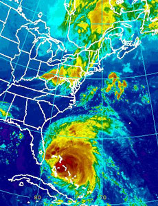
So Irene, the massive hurricane aimed straight for the East coast, is in quite a hurry to come visit us, with winds reaching 115 mph. And it’s looking like she’s bearing down on New York City. One little problem: nyc.gov is down, which makes it pretty difficult to check out whether or not you should run for cover or kick back and relax.
Sites go down all the time, and normally the only ones ever really hurt by it are the sites themselves, losing valuable clicks. This time, the public safety has come into play, so we thought we’d give you guys a couple other resources to figure out what’s happening as Irene blasts her way up the East coast.
Project.WNYC.org has a very detailed map of the different potential flood zones on a map so you know just how bad it may get. The National Hurricane Center has a list of advisories for the entire East coast, while Ready.gov has information on the possible damage that comes with different category-level hurricanes. If you put the category information you get from NHC with the possible damage on Ready.gov, you may have a pretty clear indicator of what’s to come.
Unfortunately, almost all of the “official” sites that declare the need for evacuation are part of nyc.gov, and thus, can’t be accessed at the moment. MSNBC has a nice Hurricane Tracker that lets you input your zip code to get a five-day forecast of the wind speeds you may encounter in your area. That should help you make a decision over whether or not you may need to start packing things up. There’s also an app for that.
We’ll be sure to update you as soon as nyc.gov is up and running.
Update: We’re back up and running with nyc.gov. Here’s the zone finder to see if you live in an evacuation zone. Good luck and stay safe!