 A handful of Ivy League researchers recently came up with a solution to post-conflict landmine location that employs none other than our favorite pocket companion: a smartphone.
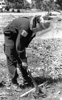
As of now, most humanitarians actually willing to go hunt for landmines must listen to audio feedback from a metal detector. This means that volunteers must get a little too close for comfort, potentially costing lives. Let’s add to that the fact that non-landmine debris is virtually indistinguishable from the real thing, forcing metal detector operators to stop and inspect every bit of metal in the field. If that weren’t enough, new mines are designed using very little metal, making them nearly invisible to de-miners, and thus a huge threat.
Not only do these obstacles waste time, but they can also cost lives, which is why those aforementioned researchers developed the Pattern Enhancement Tool for Assisting Landmine Sensing, a.k.a. PETALS. The PETALS system makes use of the smartphone, which maps out the terrain, as well as potential landmines, offering a visual schematic of the dangerous area.
PETALS is relatively cheap and easy to employ, but the real bonus to the system is the fact that newbie de-miners improved performance by 80 percent, according to the Harvard Gazette. In other words, more bang for your buck – minus the boom.