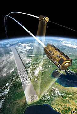
Leave it to Germany to create the most detailed 3D map of the planet that has ever existed. Two satellites, TanDEM-X and TerraSAR-X, are flying above the surface of the planet to create the map. The thing is, the satellites are extraordinarily close to each other, getting as close as 350m away from each other as they cruise at a fine speed of 7km/s.
The satellites were launched back in 2007, and the images they produce will be used for any number of things. The BBC lists airline navigation and better figuring out what areas could be at risk for a flood.
The map the satellites produce will be completed by 2014.
That is Italy on the left, correct? I’m almost positive I can see the San Siro.