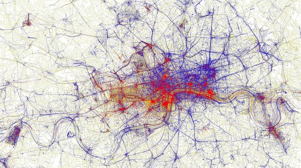
These maps, by Eric Fisher, are the result of interpreting geotagging data for Flickr photos taken in popular cities. Red dots mean tourist photos, blue dots mean locals. Personally I don’t see a lot of utility in geotagging, at least for myself, but hot damn does it make for some interesting (and beautiful) data.
Above you see London; there are dozens more in the set. Check it out.
[via Metafilter]