A year ago, Mapbox, the open-source based map provider that competes against the likes of Google and Here for B2B deals for customized and in-app maps, raised one of the biggest rounds ever for a mapping startup. And as it continues to grow out its existing business (which serves customers like Foursquare, Mapquest, Pinterest, Instacart and others), Mapbox is also taking its ambitions into a higher gear. Today the startup is unveiling Mapbox Drive, a new version of its mapping data designed for use in cars equipped with autonomous navigation capabilities.
Mapbox’s CEO and founder, Eric Gundersen, tells me that the company is very close already on a deal with a car company to use Mapbox Drive in its vehicles, and says that the opportunity more generally is a big one. That is underscored not just by the acquisition of Here by a car consortium, but the investments made by companies like Toyota, VW and GM not just to build their own autonomous car fleets, but also to partner up with some of the most likely users of those vehicles: on-demand transportation companies.
“All car companies now want to take a software-first approach,” he says, as they invest more into what the future car will look like. “They have been trying to build up external expertise.”
Recent research from Chetan Sharma indicated that in the first quarter of 2016, 69% of new cellular accounts came not from smartphones but from cars, tablets and IoT devices.
That’s a sign of how things are shifting, but it also signals the importance of people actually getting good and useful content, lest they assume the services are not worth having otherwise. In cars, that will come down to things like maps.
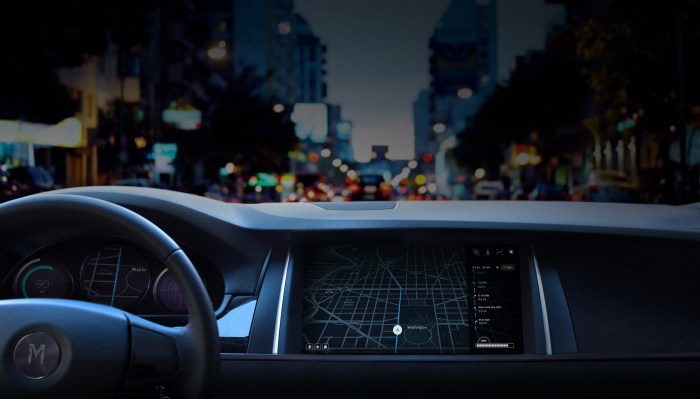
Mapbox Drive will include navigation data that incorporates real-world driving conditions; an ADAS map with centerlines and topology for autonomous vehicles (level 3 and level 4); and real-time traffic conditions. As with the original Mapbox SDK, the idea here is that the startup is using raw data from Open Street Map, and is then making it more unique and useful by ingesting and updating data, at the same time that it is providing it to customers.
That is to say, the company is using sensors on cars (and phones and whatever else is using Mapbox apps) to pick up more location information, when then gets anonymised and used to keep its maps as accurate as possible.
This is already a large operation for the company. Gunderson tells me that last week the company covered 100 million miles of telemetry data for its maps, and has been collecting data (just location, not identification, data) for the last 18 months.
And notably, Mapbox’s approach is potentially disruptive to older, incumbent mapping providers who have not traditionally picked up location data from sensors, but from the costly process of using vehicles that comb roads and record them, alongside purchasing satellite imagery.