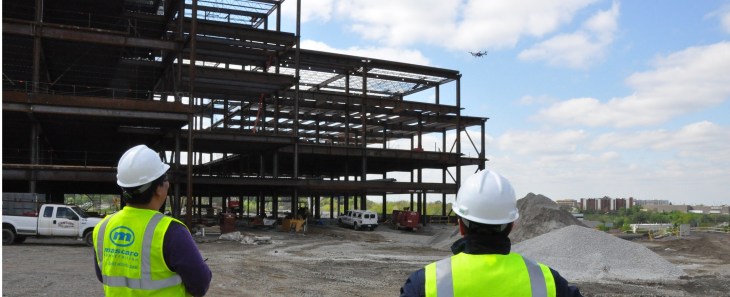
Mapping a job site – be it a construction site, oil field, or giant human battery pod factory – is a tough job. That’s why Identified Technologies’ Dick Zhang wants you to send in the drones.
His company, which is funded to the tune of $2 million, allows you to send a quadcopter around your job site to create a topographical map of the situation. It is completely autonomous, and the batteries can be hot-swapped as the drone maps. The system comes with a base station where the drone comes to roost when its done.
The company is already profitable with a number of contracts in Pennsylvania.
“We have a heavy focus in the Marcellus Shale region, which delivers over 40 percent of this country’s natural gas. We’ve experienced consistent growth every month. We are forecasting 10x growth in our deployments and revenue over the course of the year,” said Zhang.
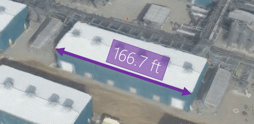
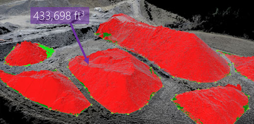
Normally jobs sites like this hire planes to fly over the job site and take photographs. However, because this turnkey operation can be launched anywhere and by anyone you can map your site far sooner and far quicker than traditional methods. Instead of months of processing, job sites can be mapped in six hours.
Obviously the system is pricey and Zhang expects to offer subscription and paid services using the tool. However, if it saves time and money in your next major construction project/secret underground lair it will end up being a real hit.