Drones deliver champagne and cookies to our hotels and chocolate to our bellies, and promise to follow our every move. Now a new site delivers us via drone to over 1,500 destinations using an interactive map.
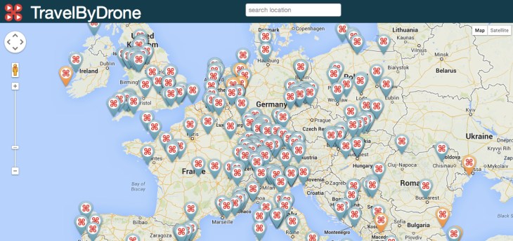
Switzerland-based developer Jan Hiersemenzel launched TravelByDrone in April to give us a bird’s-eye view of the world using drones. The site is basically a database of YouTube videos that users upload and pin to a location on an interactive Google Map.
Hiersemenzel is obsessed with all things drone. He’s worked with drone aerial videography for over a year now, making and looking at hundreds of videos, and jots off the names of the best ones for getting good video — the DJI Phantom Vision being a favorite. But he says he couldn’t find a database where all the videos of all the cool places there were to see in the world existed.
“I remember when Street View came out. I was obsessed and so were my friends. I would look all over the world and travel to new places. I thought, okay, we can do that, but now with drones,” says Hiersemenzel.
There are some really cool aerial shots of various places on the site (I could personally spend hours going through them). Hiersemenzel tinkers around a bit on the site’s search bar while we are on a long distance call: “Oh, I have to show you the one where the guy flies his drone almost straight into a volcano!”
Here’s the shot he was talking about, just off of Fiji (the volcano erupts just as the drone flies away and it’s amazing.):
And here’s another one at sunrise going over the Twin Peaks neighborhood of San Francisco:
Drone enthusiasts send Hiersemenzel and his team of four about 100-200 drone videos on a daily basis. Right now, he or someone on the team has to vet them all for quality.
Anything military-related is automatically banned (Hiersemenzel wants to keep the negative side of drones out of it). He also vets for anything low quality or too commercial, though there are a few GoPro and other ad videos that have slipped through.
There are a lot of videos in some parts of the map and a total lack in others, like North Korea where YouTube is banned. But with more users adding to the site every day, Hiersemenzel hopes to fill in a lot of gaps.
We chatted a bit about my own home state of Utah and a lack of video there. “Add some!” he tells me, and points out the several National Parks videos already on the site — although those are tough to get. Some parks are trying to ban drones from flying over and taking shots.
However, the site definitely has legs for a lot of armchair travel and education about the world. A drone recently discovered some ancient petroglyphs in Southern Utah. The petroglyphs can’t be seen from hikers on the ground.
TravelByDrone is just a website right now. There’s no funding except for a banner ad at the bottom, and sometimes the site is kind of slow. But Hiersemenzel and his team are working on an app and some other upgrades to make it better. The site, according to him, gets around 60K views a day from all over the world.