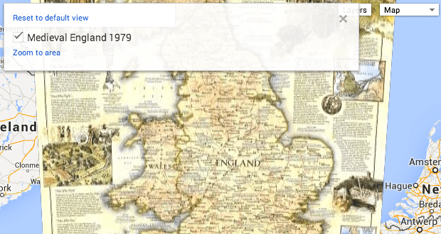
Google is launching an initiative to let organizations share their map data with the public, via Google’s Maps product and cloud-based infrastructure, and today partner National Geographic announced their participation in the project and shared some info via the official Google Maps blog. The partnership will mean that more than 500 reference and historic maps will now be available to browse as an additional layer on Google’s digital Maps engine.
This will let National Geographic explore interactive models complete with annotations that should help the archives come to life more effectively, and really animate issues of environmental change or provide education on important events throughout history. At a very basic level, this also makes available to many what was once hidden away in archival storage, visible only to those few historians who sought it out.
It’s not just about making things available free, however: National Geographic’s Frank Biasi, Director of Digital Development for NatGeo’s Maps, says there’s an added opportunity in that they can license or sell high-res and print editions of any map they make available through Google’s public data initiative, driving revenue back to the organization to support their nonprofit efforts.
Cartography may seem like fairly well-covered territory at this point, but combining the old and the new like this could be generative of very interesting comparative studies. Plus, putting them in front of more eyeballs means more potential for discovery by a wider pool of researchers, amateur and pro alike. After all, it never hurts to double check.