Google Maps can transport a person stuck in Flint, Mich. to nearly any street in America. Go diving at the Great Barrier Reef. Explore art galleries. And now, thanks to some men in heavy jackets, a lowly cubical drone can now explore a tiny Canadian town in the Arctic circle and more than 90 ski resorts around the world.
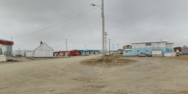
The Street View team spent a bit of time in the Great White North. As the blog post explains, last August, Google visited the tiny Canadian town of Cambridge Bay, Nunavut. Located in the Kitikmeot Region, this small town with a population of only 1,400, received the full Google Street View treatment. The team mapped all the streets and several of the buildings using the Street View trike and tripods. This place is so far North that if you look closely enough, you’ll probably see Santa or inebriated elves.
Google started mapping ski resorts in 2010 in preparation for the Winter Olympics in Vancouver. The imagery was captured using a snowmobile and provided an unparalleled look at the sloops. California-area ski resorts were added in 2011. And just today, Google announced that there are more than 90 ski resorts mapped around the world.
With this latest data, Google Maps now has imagery from runs in Switzerland, Sweden, Italy, Canada and even more in the U.S.