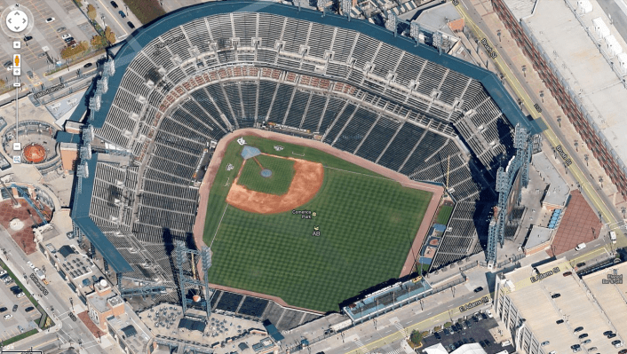
Google Maps gets more awesome by the day. Earlier this week, the service started rolling out stunning underwater imagery- if you will, a seaview mode. Now Google took to the Google Maps blog to announces the inclusion of more high resolution images including a major build-out of 45-degree images.
This update brings a lot of new data to the mapping service. Google Maps and Earth now features 17 cities and 112 countries and regions with high-resolution aerial and satellite imagery. In addition, 51 cities can now be viewed in a 45-degree mode including 37 cities in the US and 14 abroad (full list below). It’s never been easier to burn a little time and escape from your cubical to a far away land.
Google constantly rolls out updates to its services but it seems this week has featured more news than usual. Perhaps Google is attempting to cash in on all the positive publicity it’s receiving thanks to the inferior Apple Maps.
Google Maps is currently riding high on the wake of the Apple Maps fiasco. In fact Apple CEO Tim Cook issued a formal apology for Maps, suggesting Google Maps and Bing Maps as alternatives until Apple sorts things out.
Below is the full list of cities featuring high-resolution and 45-degree imagery. Go ahead. Find your house.
Cities with new high resolution 45° imagery:
United States: Ames, IA; Anderson, IN; Billings, MT; Bloomington, IL; Carmel Valley, CA; Cedar Rapids, IA; Coeur d’Alene, ID; Corvallis, OR; Danville, IL; Dayton, OH; Detroit, MI; Dubuque, IA; Elizabethtown, KY; Enid, OK; Florence, SC; Grand Forks, ND; Great Falls, MT; Gulfport, MS; Hartford, CT; Kankakee, IL; Kenosha, WI; Lafayette, IN; Lancaster, CA; Lansing, MI; Lewiston, ID; Los Banos, CA; Madison, WI; Medford, OR; Michigan City, IN; Olympia, WA; Pocatello, ID; Sheboygan, WI; Sioux City, IA; Sioux Falls, SD; South Bend, IN; Terre Haute, IN; Utica, NY.
International: Angers, France; Clermont-Ferrand, France; Coimbra, Portugal; Dijon, France; Grenoble, France; Livorno, Italy; Lyon, France; Newcastle, United Kingdom; Oberhausen, Germany; Palermo, Italy; Pisa, Italy; Toulouse, France; Troyes, France; Winnipeg, Canada.
Areas with new high resolution aerial updates:
Florence OR, Kellogg ID, Casper WY, North Platte NE, Concordia KS, Alva OK, Austin TX, Nevada MO, Chilicothe MO, Toulouse FR, Clermont-Ferrand FR, Angers FR, Nantes FR, Troyes FR, Lille FR, Thun CH, Lucca IT
Areas new high resolution satellite updates:
Canada, United States, Mexico, Cuba, Jamaica, Haiti, Dominican Republic, Guatemala, Honduras, Nicaragua, Costa Rica, Panama, Colombia, Venezuela, Brazil, Peru, Bolivia, Paraguay, Uruguay, Argentina, Antarctica, South Africa, Namibia, Botswana, Mozambique, Zimbabwe, Madagascar, Zambia, Angola, Malawi, Tanzania, Democratic Republic of the Congo, Kenya, Somalia, Ethiopia, South Sudan, Sudan, Uganda, Central African Republic, Nigeria, Cameroon, Chad, Niger, Benin, Ghana, Burkina Faso, Ivory Coast, Guinea, Sierra Leone, Mali, The Gambia, Senegal, Mauritania, Western Sahara, Morocco, Algeria, Tunisia, Libya, Egypt, Israel, Saudi Arabia, Yemen, Oman, Qatar, United Arab Emirates, Kuwait, Turkey, Iran, Ireland, Norway, Sweden, Portugal, Spain, France, Italy, Poland, Lithuania, Finland, Belarus, Ukraine, Moldova, Romania, Hungary, Austria, Croatia, Serbia, Bulgaria, Greece, Russia, Kazakhstan, Uzebekistan, Turkmenistan, China, Pakistan, India, Sri Lanka, Bangladesh, Thailand, Nepal, Bhutan, Myanmar, Laos, Vietnam, Korea, Japan, Mongolia, The Philippines, Malaysia, Indonesia, Australia, New Zealand
