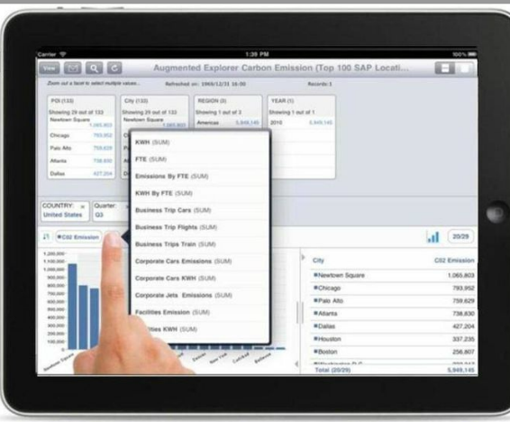
Business software giant SAP is collaborating with Google to offer an updated software product in its BusinessObjects Explorer, that helps customers manage and layer large data volumes with Google Maps and Earth. The product puts SAP’s enterprise analytics on top of the interactive mapping and satellite capabilities in Google Maps and Google Earth and provides customers a way to visualize, analyze and manage “big data” via Google’s map, satellite and street-level views.
SAP says its Location-based intelligence allows customers to analyze their businesses data in a geospatial context to understand the “where” of their information, as well as global, regional and local trends and how they are impacted by different scenarios.
For example, a telecom operator will be able to use Google Earth and SAP software to perform dropped-call analysis and pinpoint the geo-coordinates of faulty towers. Or a state department of revenue will be able to overlay household tax information on a map of the state and group it at the county level to track the highest and lowest tax bases. And U.S. census data can be overlaid on a Google map of the country, grouped by state and drilled down on at the county level.
Google also offers companies Google Earth Builder, which allows users to upload, process and store geospatial data in the Google Cloud. But SAP actually allows companies to bring in business analytics and data into Maps and Earth applications.