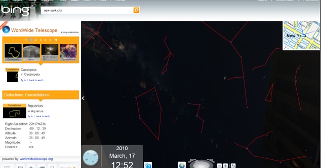
If you can’t tell your Belt of Orion from your Little Dipper, Microsoft is here to help. Today it added its WorldWide Telescope application to Bing Maps. The application let’s you look up at the sky from a street view level in a map and see the stars and planets conveniently identified by red lines connecting them together.
Microsoft debuted its WorldWide Telescope application two years ago, and it’s existed as a standalone desktop and Silverlight app. But now that it is part of Bing Maps, it should become more popular. (Inside Bing Maps, you first need to click on “Map Apps” and select WorldWide Telescope to enable it).
The app is not just for identifying constellations and planets. The menu on the left allows you to load up all sorts of data from sky surveys, the Hubble Telescope, and other astronomy data sources. The navigation isn’t as fluid as it could be, but at least it gives you a point of orientation to make sense of the night sky. What Microsoft needs to do is bake this into its Bing iPhone app so that you can see the constellations identified through your camera viewfinder.