 Google may be environmentally conscious, but they certainly not helping the rest of us get around any greener. Currently, Google’s public transit mapper, Google Transit, only deals with bastions of public transit like Orange County and Duluth Minnesota, leaving those of us in San Francisco, New York and just about everywhere else squinting at bus maps.
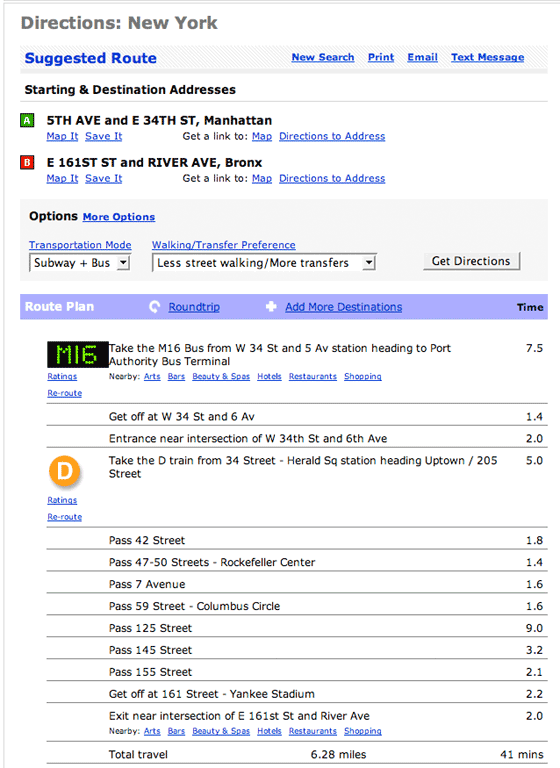
Transit planner HopStop, however, takes on these larger metros, providing coverage for Boston, Chicago, San Francisco, New York, Washington D.C., and several cities in New Jersey. For each city, HopStop will plot directions and estimate travel time by foot and public transit (bus / subway) between two or more addresses. It also comes with some other really useful features. You can choose which travel method you would prefer more, walking, busing, subway, or a combination of the three. Also, since you don’t always know the street address of your destination you can pick it from a map.
Aside from directions, HopStop has some nascent local guides and a business directory. And if you don’t like the interface, there’s also a developer API.
NY and London based TechCrunch readers should also check out Greg Brail’s Transit Maps.